
AGAT is a synthetic turf designed to optimise primary and secondary groundcover for airports, landing strips, and helipads.
References
On this page, you will find more information about the airports where Aviation Grade Artificial Turf (AGAT) have been installed.

 – Evergreen Aviation")
 – Evergreen Aviation")


Airport/City: Copenhagen Airport, Roskilde
IATA – ICAO: RKE – EKRK
Country: Denmark
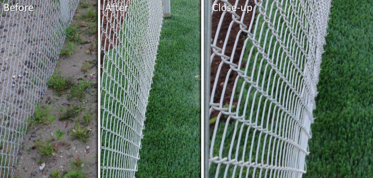
Location: Security Fence/Service Road South
Description: Perimeter fence 20.000 m2
Coordinates: N 55°35’00″/E 12°07’54”
Year: 2018

Airport/City: London Southend Airport, London
IATA – ICAO: SEN – EGMC
Country: United Kingdom
Location: RWY 05
Description: 450 m2 Jet blast area
Coordinates: N 51°33’54″/E 00°40’53”
Year: 2018

Airport/City: Sygehus Soenderjylland, Aabenraa
IATA – ICAO: Private
Country: Denmark
Location: Emergency input
Description: Hospital Helipad (HEMS) 19 x 19 meters
Coordinates: N 54°54’58″/E 09°47’12”
Year: 2018

Airport/City: Roedvig Airfield, Stevns
IATA – ICAO: Private
Country: Denmark
Location: Helicopter appron
Description: 19 x 19 meter with TWY to the hangar
Coordinates: N 55°15’40″/E 12°18’12”
Year: 2018

Airport/City: London City Airport, London
IATA – ICAO: LCY – EGLC
Country: United Kingdom
Location: RWY 27 / TWY M
Description: 360 m2 Jet blast area
Coordinates: N 51°30’16″/E 00°03’58”
Year: 2017

Airport/City: Exeter Airport, Devon, England
IATA – ICAO: EXT – EGTE
Country: United Kingdom
Location: Exeter EX5 2BD
Description: Helipad ø12 and walkway with logo
Coordinates: N 50°44’04″/W 03°24’50”
Year: 2017

Airport/City: Chesham, England
IATA – ICAO: Private
Country: United Kingdom
Location: Ashley green road Bucks, HP5 3PF
Description: Pressmore lodge private helipad ø12
Coordinates: N 51°43’39″/W 00°35’50”
Year: 2017

Airport/City: Billund International Airport, Billund
IATA – ICAO: BLL – EKBI
Country: Denmark
Location: Air Service
Description: Helipad 15 x 20 m
Coordinates: N 55°44’25″/E 09°206’09”
Year: 2016

Airport/City: Karup Airport, Military air base in Karup
IATA – ICAO: KRP – EKKA
Country: Denmark
Location: Flight Training Academy
Description: Groundcover installation 2 x 2 m under cones
Coordinates: N 56°17’51″/E 009°07’29”
Year: 2016

Airport/City: Tribhuvan International Airport, Katmandu
IATA – ICAO: KTM – VNKT
Country: Nepal
Location: RWY 2/20 – TWY J
Description: TWY J, with center marking along RWY 02/20
Coordinates: N 27°42’30”/ E085°21’53”
Year: 2015

Airport/City: Tribhuvan International Airport, Katmandu
IATA – ICAO: KTM – VNKT
Country: Nepal
Location: Helicopter Appron
Description: Double helipad
Coordinates: N 27°41’53”/ E085°21’42”
Year: 2015

Airport/City: Karup Airport, Military air base in Karup
IATA – ICAO: KRP – EKKA
Country: Denmark
Location: RWY 32/27L
Description: Intersection and PAPI
Coordinates: N 56°17’52”/ E009°07’15”
Year: 2014

Airport/City: Karup Airport, Military air base in Karup
IATA – ICAO: KRP – EKKA
Country: Denmark
Location: TWY S
Description: Decommissioned parking no. 122-124 along TWY S
Year: 2014

Airport/City: Esbjerg Airport, Esberg
IATA – ICAO: EBJ – EKEB
Country: Denmark
Location: RWY 26
Description: PAPI installation
Coordinates: N 55°31‘33”/ E008°33’12”
Year: 2013

Airport/City: Odense Airport, Odense
IATA – ICAO: ODE – EKOD
Country: Denmark
Location: RWY 13/31 –TWY C
Description: Grass RWY & TWY makings and lamps
Coordinates: N 55°28‘36”/ E010°19‘19”
Year: 2013

Airport/City: Billund Airport, Billund
IATA – ICAO: BLL – EKBI
Country: Denmark
Location: Check Point Nord
Description: Security fence
Coordinates: N 55°44‘25”/ E009°06‘09”
Year: 2013
Airport/City: Maanedalen, Hoersholm
IATA – ICAO: Helipad installation
Country: Denmark
Location: ITG
Description: Private helipad, 12×12 m, with access ramp
Coordinates: N 55°50’42”/ E012°29’41”
Year: 2013

Airport/City: Skipperly, Vejroe
IATA – ICAO: Private
Country: Denmark
Location: In front of the restaurant
Description: Private helipad 12x12m
Coordinates: N 55°02’21” E011°21’49”
Year: 2013
